Montenegro is located in Southeast Europe, on the Balkan Peninsula. It borders Croatia to the west, Bosnia and Herzegovina to the north, Serbia to the east and Albania to the south. The Adriatic Sea separates it from Italy. The length of the land border is 614 km, and the length of the sea border is 293.5 km.
 The climate in Montenegro is complex, which is conditioned by the latitude, the proximity of the sea, the relief and the position of the mountain massifs next to the coast. There are several climate zones: Adriatic-Mediterranean in the south, variable Mediterranean in the lowland part of the country (Skadar basin and plains), moderate continental in the valleys and dales and sharply mountain climate in the mountainous part of the country.
The average temperature: 27.4 ° C (summer)
The longest beach: Velika plaža 13.000 m
The deepest canyon: Tara river 1,300 m
The largest bay: Bay of Kotor
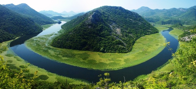
The largest lake: Skadar Lake 369.7 km2 (147.9 km2 belongs to Albania)
The highest peaks: Bobotov Kuk (Durmitor) 2,522 m and Maja Rozit (Prokletije) 2,522 m
National parks: Skadar Lake 40,000 ha, Durmitor 39,000 ha, Biogradska gora 5,400 ha, Lovćen 6,400 ha
UNESCO World Heritage Sites in Montenegro:
• Durmitor
• Kotor